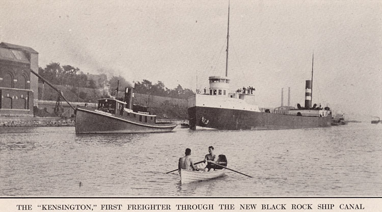
Ship Lock in Black Rock harbor pre-1910. Image source: Buffalo Express Yearbook
Black Rock's advantage as a harbor were immediately apparent to entrepreneurs like Peter Porter in the first years of the 19th century. The large rock outcrop that gave the location its name created an eddy on its northern side where boats could dock away from the Niagara River current. Until the War of 1812, its proximity to the Canadian shore, three-quarters of a mile away, was advantageous for the ferry service between the two shores. There was one major disadvantage to the location, however. Lake Erie empties into the Niagara River a short distance upstream from Black Rock, creating rapids, reefs and a fast-moving current at the location of Black Rock. Porter & Barton had the primary waterborne business in shipping salt to Buffalo and Erie, Pennsylvania beginning in 1805. The company's work was made expensive, laborious, and time-consuming because moving the salt-laden Durham boats upstream into Lake Erie required either "ash breeze" (rowing) or "horn breeze" (towing from shore by oxen).
Even the first steamboat, the Walk-in-the-Water, built in Black Rock, could not generate enough power to propel itself through the Niagara River to Lake Erie. It was towed, while under full steam, by the "horn breeze," six yoke of oxen, into Lake Erie. It became apparent that, if the region were to develop its shipping business, Buffalo would be the best location for the region's major harbor. Nothing was done to create a proper harbor in Buffalo, particularly the dredging to remove the sand bars at the mouth of the Buffalo River, until the Erie Canal began its construction across the state. Buffalo succeeded in creating the harbor and the Erie Canal was constructed through Black Rock and to Buffalo in 1825. The project required that the "black rock" which named the village be blown up.
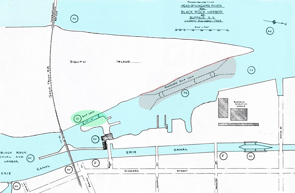
1903 map. Image source: Maps Buffalo Harbor 1804 - 1964
Black Rock's harbor received improvements at this time, including access into the Erie Canal. As the above map shows, the canal was excavated through the village, separate from the harbor. Water from the river flowed freely into the canal which was 8 feet lower than the river. This watered the canal to a point east of Rochester. To protect the canal from storm surges, a "guard lock" was constructed, visible in the canal stream above. Boats normally passed through the guard lock; it was closed only during storm surges. The rapid flow of water into the canal generated interest on the part of grain millers who wanted to install millraces that would utilize it. New York State issued leases to them, which it later came to regret. Flour millers included the Globe, Niagara, Queen City, Clinton, Frontier, and Erie. By 1874, the millers were diverting so much water that the canal faced a shortage. That would be addressed by a new law passed in 1903 but water power was by then becoming history. Those mills that had not burned down switched to electricity.
The green circle above highlights the ship lock constructed in 1832 as part of the Erie Canal funding from New York State. The first lock was made of timbers which quickly began to deteriorate and leak. The U.S. Government took over ownership of the ship lock in 1829 as a matter of national defense. A replacement lock was constructed of stone, visible in the photo below. By the end of the 19th century, extensive plans were laid for the construction of a long channel (Black Rock Channel) with deep dredging for "the largest deep-draft vessels" and a new, super-sized lock to accomodate these ships. This lock was considered necessary because businesses north of Black Rock required shipments of iron ore, coal, and petroleum which were carried in lake freighters. In the map above, the new lock is highlighted in gray.

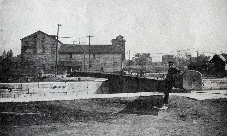
View looking north from Squaw Island side of Black Rock, 1909. The old lock is at left; beyond that is construction of the
new lock we know today. At right is the Erie flour mill, which had a millrace that used water from the entrance to the Erie (Barge) Canal to power its grist wheels. Image source: Maps Buffalo Harbor 1804 - 1964
Work began on the new lock in 1909 and finished in 1914. Construction required dredging as well as blasting solid rock to create the 21-foot deep and 200' wide lock and the 3 1/2 mile channel. A 56,000-lb. Lobnitz rock cutter was brought to Buffalo in pieces and assembled. This work widened the Black Rock harbor and extended the channel, forcing boat owners out of their berths all along the route. Given notices to move in 1908 were 75 boat houses, the Motor Boat Club of Buffalo and the Buffalo Launch Club. Every alternate mooring the affected parties suggested was refused. One frustrated boat owner said the ship canal construction was "driving us off of the earth!"
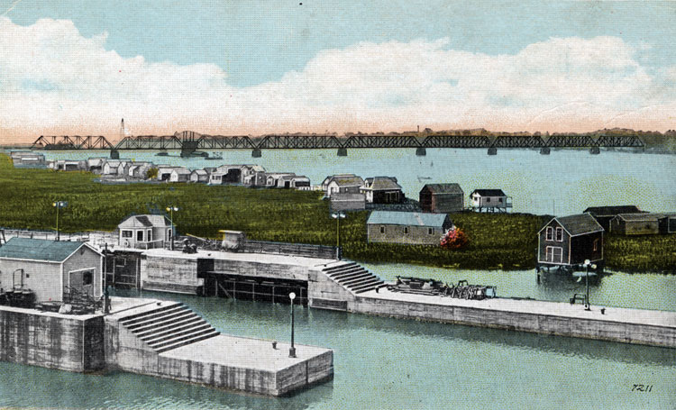
Postcard view of the new locks after 1914, looking very much as they do today. Boathouses and dwellings are visible on the river side of Squaw Island. Image source: private collection
1914 photo from the Buffalo Express yearbook.
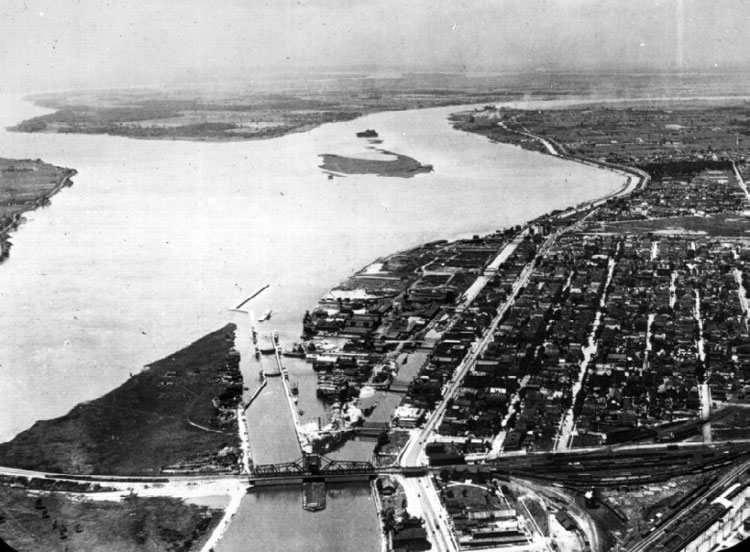
Aerial view, 1920s.
The Black Rock harbor had been created to handle traffic for both river and canal. The swing bridge constructed for the International Railroad Bridge served both.
Black Rock Lock today.
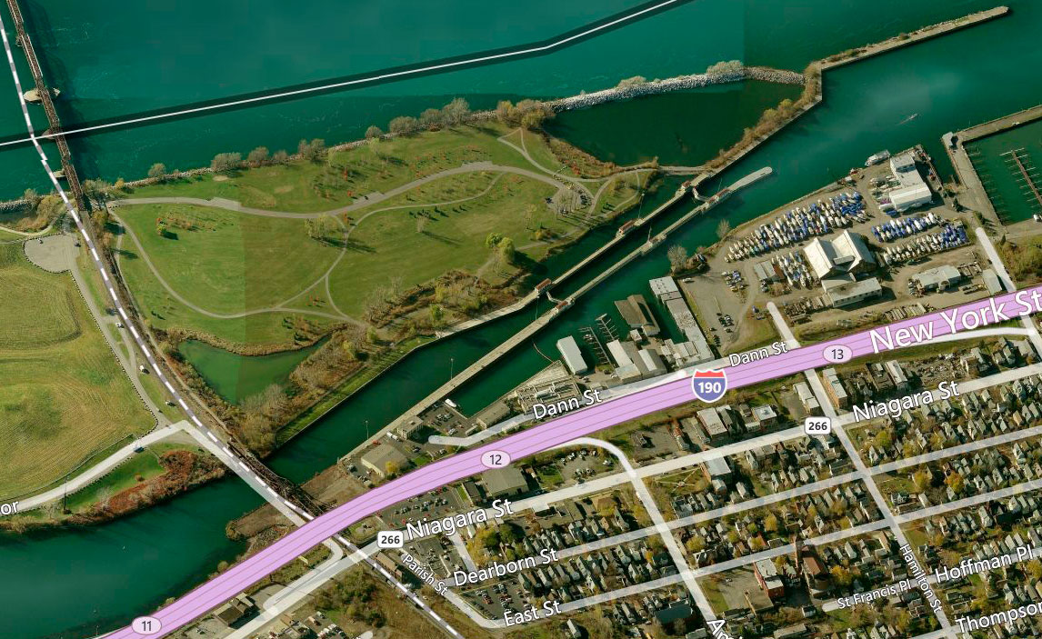
The Bing map above shows that today only the Black Rock Lock exists. The New York State Thruway was built on the bed of the canal in the 1950s.
Bing Map detail view showing the former entrance to the Barge Canal still visible at Black Rock.
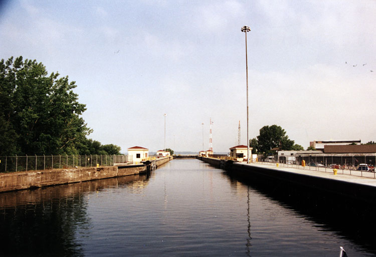
Entering the Black Rock Lock (1999), looking toward Grand Island.
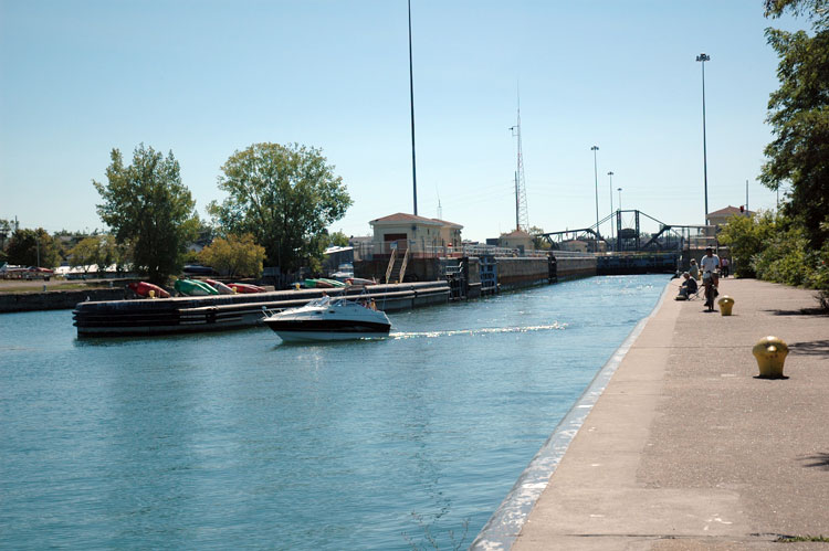
Boat exiting the lock, looking toward Buffalo.
In 2014, the Black Rock Lock celebrated its 100th anniversary. It underwent a major rehabilitation in 1975, with additional mechanical upgrades in 1984-86. Beginning in the 1990s, work to strengthen the foundation and approach walls was completed, in addition to replacement fencing, railings and ladders for safety. It is maintained by the U.S. Army Corps of Engineers. Although it was used in recent years to lock a lake boat supplying coal for the Huntley generating station, the lock is primarily used by recreational boaters.